2D LiDAR Detection & Clustering: From Breakpoint to Dual-Stage
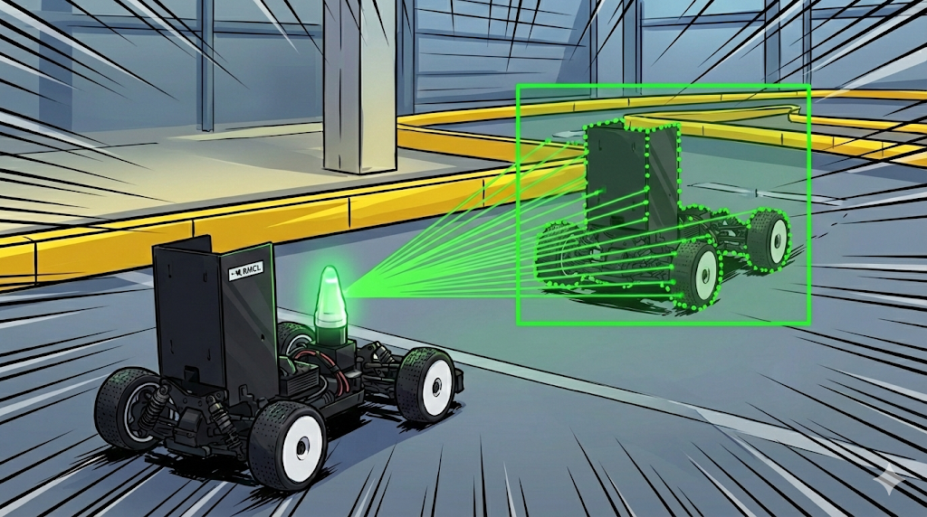
During a race we need to track not only the static obstacles on the track but also the constantly moving opponent cars in real time. This post walks through how to detect such targets with just a single 2D LiDAR.
Starting Point: How to Group a LiDAR Pointset
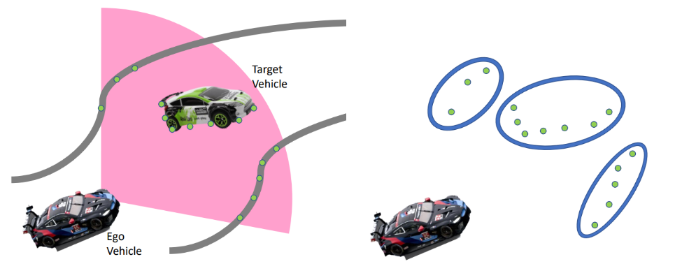
What a 2D LiDAR gives you is, in the end, a set of points scattered on a plane (a pointset). Finding “which points belong to one object” is exactly clustering.
There are many general-purpose techniques for clustering a pointset.
k-means — partition into a predefined number $k$ of groups
DBSCAN — density-based, robust to arbitrary shapes and noise
GMM (Gaussian Mixture Model) — model as a mixture of several Gaussians
…
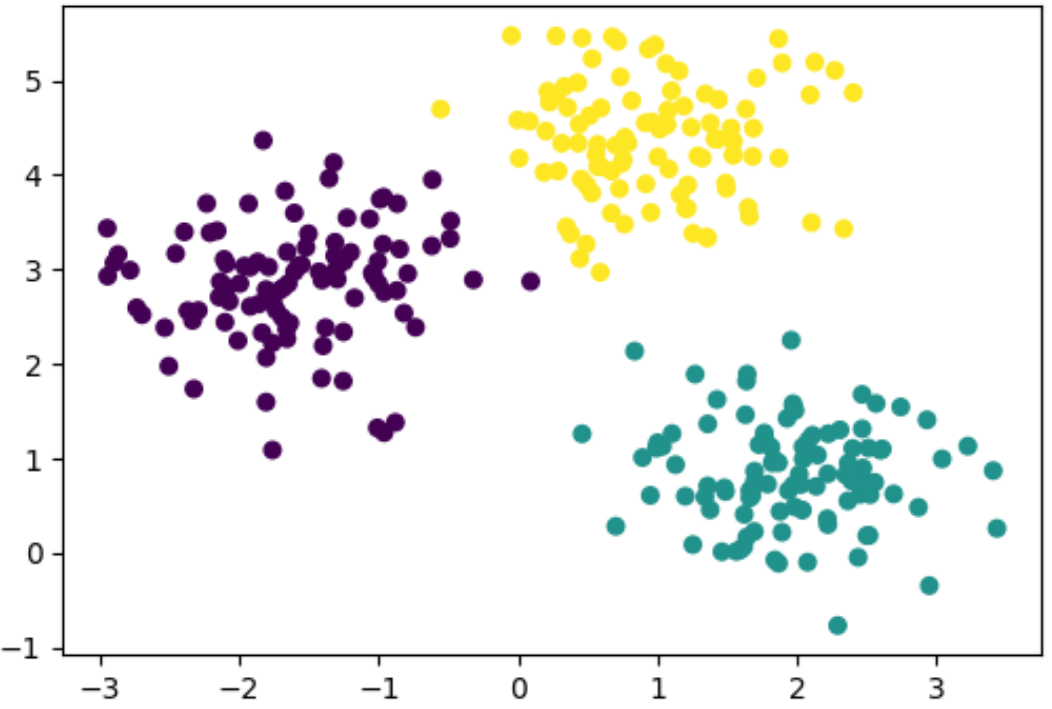
The real problem is that these methods assume our data is harder than it actually is. The algorithms above treat the points as an unordered scatter, recomputing “who is close to whom” from scratch every time. On top of that, k-means and GMM need to know the number of objects ($k$) up front — but we have no idea how many obstacles are on the track.
Yet a 2D LiDAR scan is not an unordered set. It is a sequence sorted by angle (ranges[0], ranges[1], …), and points that are neighbors in the array are also likely to be neighbors in space. In other words, the “which point sits next to which” information is something the sensor already hands us, pre-sorted, for free.
So the problem is neither “accuracy” nor “speed” — it is that we aren’t using information we already have (the ordering of the points). Just by exploiting this order, with no all-pairs distance computation and no $k$, we can separate objects in a single pass over the scan.
Exploiting the Order: Breakpoint
Because the laser rotates in one direction and measures distances sequentially, the points arrive in order of increasing scan angle $\phi$. And points reflected from a single object fall into a contiguous angular interval.
So instead of searching all points, we only need to check the distance between the previous point and the current point. The moment that distance exceeds a threshold is the boundary between objects — a breakpoint.
Clustering then finishes with just a single pass over the points ($O(n)$). Both approaches handle 40Hz comfortably, but this one does the same job far more cheaply — with no all-pairs distances. The representative algorithms are the Breakpoint Detector and, adapting the threshold with range, the Adaptive Breakpoint Detector (ABD). On top of that, we’ll also look at the Dual-Stage Adaptive Breakpoint Detector, which handles the over-segmentation caused by real-world outliers.
1. Breakpoint Detector
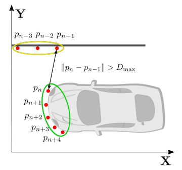
The simplest starting point. If the distance between two angularly adjacent points exceeds a fixed threshold $D_{max}$, split the object there.
\[\lVert p_i - p_{i-1} \rVert > D_{max} \quad\Rightarrow\quad \text{New Cluster}\]Since it’s an $O(n)$ algorithm that scans the points just once, it has plenty of headroom for a 40Hz stream.
The problem is that $D_{max}$ is a constant. Since LiDAR points get sparser with range, a threshold that fits nearby objects is too small for far ones, chopping a single car into several pieces.
Below is a demo where you can play with the fixed-threshold Breakpoint Detector directly. Move the sliders (angular resolution · noise · min cluster size) or place boxes, and watch how walls and cars split into several pieces at range (over-segmentation).
2. Adaptive Breakpoint Detector
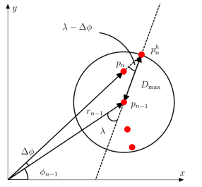
The fix is simple: grow $D_{max}$ proportionally to range $r$.
\[D_{max} = r_{i-1}\cdot\frac{\sin(\Delta\phi)}{\sin(\lambda - \Delta\phi)} + 3\sigma\]$\Delta\phi$ : scan angular interval (angular resolution)
$\lambda$ : the worst-case incidence angle of a detectable surface — a parameter setting how permissive the threshold is
$3\sigma$ : sensor-noise margin
The formula looks complex, but $\Delta\phi$ is a constant (the sensor resolution) and $\lambda$ is a tuning parameter, so if we treat $\frac{\sin(\Delta\phi)}{\sin(\lambda - \Delta\phi)}$ and $3\sigma$ as tunable values, we can rewrite it as:
\[D_{max} = a\cdot r_{i-1} + b\]That is, it can be understood as adding a range-proportional allowance $a\cdot r_{i-1}$ on top of a fixed breakpoint threshold $b$.
Geometrically, you draw a circle of radius $D_{max}$ around the previous point and connect the next point to the same object if it falls inside. The farther away, the bigger the circle, so sparse distant points are still kept as one object.
In the demo below you can play with the adaptive threshold (ABD) directly. Adjust λ (incidence angle) and σ to see how the circle (radius $D_{max}$) grows with range, and how distant objects stay unified compared to the fixed threshold.
3. Dual-Stage Adaptive Breakpoint Detector
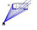
In real driving, a car is sometimes not measured continuously by the LiDAR (the over-segmentation problem). For example:
besides the detection box, the opponent’s body is also measured, and a beam passes through empty space, or
the opponent’s detection box is insufficient
At that moment ABD mistakes it for a breakpoint and splits the cluster.
When this happens, it can cause trouble in the tracking module when linking detections between the previous and current frames, and — worse — the minimum-size filter (min cluster size) that follows deletes the small fragments, so the whole car disappears. This is especially fatal for distant cars with only a few points.
The Idea: Split, But Don’t Give Up Right Away
The key is to not immediately create a new cluster when a breakpoint fires; check once more whether it can be re-attached to an existing cluster.
Stage 1 (adaptive) — try to attach to the current cluster with ABD.
Stage 2 (re-merge) — if it was split, find the nearest endpoint among existing clusters and, if within a fixed radius $\tau$, re-merge there. Only if there’s still none, start a new cluster.
1
2
3
4
5
6
7
8
9
for each point p (in angular order, on-track points only):
    if dist(p, current_cluster.endpoint) < D_max(r):     # Stage 1: ABD
        add to current cluster
    else:                                                 # Stage 2: re-merge
        c ← existing cluster with the nearest endpoint
        if dist(p, c.endpoint) < τ:
            add to c and make c the 'current'
        else:
            start a new cluster
Stage 2 is essentially one step of fixed-radius single-linkage over the cluster endpoints. It stitches back together the fragments briefly split by corners or occlusion, preserving one car = one cluster.
In the demo below, see the over-segmentation that occurs when two boxes are adjacent, and how the Dual-Stage re-merge stitches the split fragments back into one.
Wrap-up
We covered clustering a 2D LiDAR pointset in $O(n)$ by exploiting the angular ordering a rotating LiDAR gives for free. It evolves from the fixed-threshold Breakpoint Detector → the range-adaptive ABD → the Dual-Stage that stitches split fragments back — reducing over-segmentation and preserving “one car = one cluster”.
For real-world performance, the following also matter:
- Hardware — vehicle hardware and track flatness that keep things close to the 2D assumption
- map filtering — good localization performance to filter out static structures such as walls